 English
 New Outdoor Gear (showing 73 to 90 of 192)
Page:
-
 new
newAqua 1L Aluminium Water Bottle, Black
This tough yet lightweight aluminium bottle from Eurohike has a handy carabiner for easy carriage on bags, belts or harnesses.Tough and lightweight aluminium bottleNon leak screw lidCarabiner included1 Litre capacity ... Learn More
£6.50
£6.50
from 1 store -
 new
newDiscounted
Aqua Kem Blue & Aqua Rinse Concentrate Duo Pack, Navy
The Thetford Aqua Kem Blue & Aqua Rinse Concentrate Duo Pack makes cleaning out your portable camping toilet and getting rid of unwanted smells, gas build up, and the inevitable gunk and grime from the flush water easy.The highly effective formulation ... Learn More
£38.00
£24.00
£24.00
from 1 store -
 new
newDiscounted
Aqua Kem Blue Concentrated (780ml), Blue
Concentrated less space, less weight, same dosages ... Learn More
£19.00
£15.00
£15.00
from 1 store -
 new
newDiscounted
Aqua Kem Green Toilet Fluid Concentrated (750ml), Multi Coloured
Environmentally conscious toilet fluid Liquefies waste for easier tank emptying Outstanding odour control Convenient small bottle, less weight ... Learn More
£19.00
£15.00
£15.00
from 1 store -
 new
newDiscounted
Artificial Zig Rig 8mm Black, Black
Designed to catch bigger fish, The Westlake Artificial Zig Rig is particularly effective in the upper layers of the water and can be hair rigged on a long link! Coming in a pack of ten, this artificial zig rig is a must have for your days by the water.Ten ... Learn More
£1.20
£0.47
£0.47
from 1 store -
 new
newDiscounted
Artificial Zig Rig 8mm, Yellow
Designed to catch bigger fish, the Westlake Artificial Zig Rig is particularly effective in the upper layers of the water and can be hair rigged on a long link! Coming in a pack of ten, this artificial zig rig is a must have for your days by the water.Ten ... Learn More
£1.20
£0.47
£0.47
from 1 store -
 new
newBall Launcher, Blue
Allows you to throw further with less effortGreat exerciseScoop up the ball rather than handlingPerfect for playing or training ... Learn More
£4.30
£4.30
from 1 store -
 new
newBall on a Rope, Multi Coloured
Perfect for fetch or tug of war, this ball on a rope will provide hours of entertainment for your canine companion.Fun toy for dogsPetface brandingColour** Pets should be supervised whilst playing with toys. Although Petface toys have been designed to ... Learn More
£1.70
£1.70
from 1 store -
 new
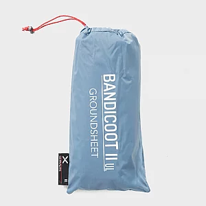
newBandicoot II UL Groundsheet, Blue
Add ground protection to your ultralight camping setup with this groundsheet from OEX. Designed for the Bandicoot II UL, it keeps your tent fabrics clean and dry, making it easier to pack away without needing to air it out. · Material ... Learn More
£33.00
£33.00
from 1 store -
 new
newDiscounted
Barbecue Fire Lighter Blocks, Blue
The Quest BBQ Lighter Blocks are simply lighter Blocks for your barbeque. Enjoy the taste of freshly cooked meat or veg this summer without any hassle, just light and cook! ... Learn More
£2.50
£2.00
£2.00
from 1 store -
 new
new -
 new
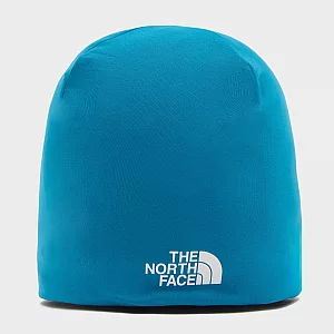
newBase Beanie, Blue
Made using moisture wicking FlashDry technology, this beanie hat is the perfect way to stay warm without working up a sweat. The stretch fabric creates a close to skin feel so you can comfortable wear a helmet on top.FlashDry fabric moisture wicking and ... Learn More
£22.00
£22.00
from 1 store -
 new
newDiscounted
BaseFresh® 1L, Clear
Deodorising conditioner for wicking clothing worn next to the skinRefreshes baselayers by deodorising and preventing build up of odour producing bacteriaEnhances and revitalises wicking properties and quick dry performanceApplies stain resistant coatingRecommended ... Learn More
£10.00
£9.00
£9.00
from 1 store -
 new
newDiscounted
BaseFresh® 300ml, Clear
Deodorising conditioner for wicking clothing worn next to the skinRefreshes baselayers by deodorising and preventing build up of odour producing bacteriaEnhances and revitalises wicking properties and quick dry performanceApplies stain resistant coatingRecommended ... Learn More
£4.50
£4.00
£4.00
from 1 store -
 new
newDiscounted
BaseWash™ (300ml), Clear
Keep your active clothing feeling clean and fresh with the BaseWash from Nikwax. An easy to use wash with a built in cleaner that maintains the performance of your synthetic base layers and socks. BaseWash effectively cleans and deodorises your synthetic ... Learn More
£4.50
£4.00
£4.00
from 1 store -
 new
newDiscounted
BaseWash® 1L, Clear
Deodorising cleaner and conditioner for synthetic technical underwear and wicking clothingCleans and conditions Deodorises synthetic baselayers and prevents odour build upIncreases breathability and wicking properties Accelerates drying rateWash inRecommended ... Learn More
£11.00
£9.50
£9.50
from 1 store -
 new
newDiscounted
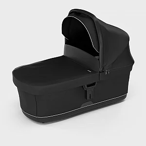
Bassinet, Black
The bassinet is ideal for infants aged 0 6 months and it includes a bassinet apron and ventilated mattress to keep your baby cosy and comfortable. Once you have finished your walk, the bassinet will easily and quietly detach from the pushchair.Easy to ... Learn More
£250.00
£225.00
£225.00
from 1 store -
 new
newDiscounted
Battery Recharger, Multi Coloured
Taking just two hours to charge, the recharger comes with four batteries included so you can start reducing battery waste straight away.· Helps save 1000 batteries minimum over long term use· Includes ready to use batteries· 2x ... Learn More
£20.00
£10.00
£10.00
from 1 store